Post Challenge Video

In preparation for our talks at the NERC Into the Blue Showcase at Manchester Airport next week we have uploaded a short video which you can watch below. Free tickets for entry to this great event are available from the website at http://intotheblue.nerc.ac.uk/manchester/ and there are a small number of research aircraft tours still available.

If you and your family are interested in environmental science, this is an opportunity not to miss!


Post Challenge Reflections

Claire and Pam recently completed an epic challenge to run 15 off-road marathons in 15 National Parks during a month in September. This equated to running a distance from London to Loch Lomond in Scotland (over 400 miles) and climbing Ben Nevis 12 times. Not content to simply run, they carried out Science experiments on route and wrote blogs about their experiences. The logistical, mental and physical challenge they set themselves was immense and bought them close to breaking point at times. However, their positive mental approach and excellent teamwork got them through.

dsc_0382

Psychology played a massive part during this endurance challenge and they worked hard together to develop strategies that would outplay the many mind games that they encountered. They made a pact to keep the slowest person in front and when someone was suffering mentally or physically, they took the lead and control of the map. The sense of responsibility they got when having to take a lead role helped them to suppress any pain or negative emotions.

dsc_0409

The only exception to this was when Pam put herself through the sugar experiment. Having predicted the catastrophic outcome of taking a sugar only breakfast prior to starting the days’ activities, Claire was tasked with taking control of the map and Pam. Pam went from being exceptionally bubbly with a spiking heart rate to suffering roaring headaches as she went through the pain of the sugar low. Pam said that on reflection this was one of the worst things that she has ever done in the name of Science!

When asked what their favourite park was they both struggled to answer. They loved the variety of the different climate, topography, geology, flora and fauna in each park; and how much this had influenced the lives of the people that lived there. Both having studied Geophysics at the University of Liverpool, they are very aware of how nature’s forces impact people and how societies achieve most when they work with their surroundings rather than battle against them. This was particularly prominent at Pickering, where careful land management of the rivers catchment area had helped to prevent flooding of the town below at the end of last year.

In addition to the differences within the parks, they also enjoyed exploring the similarities between them. Many of the parks have extensive areas of peat moorland and are working hard together to preserve this natural store of carbon. Many are also looking at renewable energy solutions within their park boundaries; the New Forest and Pembrokeshire coastline both provide many excellent examples of this. There were many surprises during their adventure but some of the most memorable had to be the height of the cliffs along the Exmoor coastal path and how temperature and relative humidity are so closely linked in the mountains. Rising to over 400 metres in height in places, the Exmoor cliffs are the highest sea cliffs in England and Wales and gave them a marathon to remember.

dsc_0227

They are both very grateful to all the support they got on route and for their family, friends and mentors for instilling in them a love for the great outdoors. Having driven from one National Park to another, run across or around them in such a short time frame, learnt so much more about the Science that drives them, they feel privileged to have seen the United Kingdom in a new light. Their final thoughts echo the comments of the many people they met on route.

“We are all very lucky to have access to these amazing parks which teach us so much about how the Earth works. We must all do our bit to inspire the next generation to protect and cherish them. No amount of money can buy the feeling you get after a long day’s run or walk in one of these magical places.”

dsc_0647

If you would like to hear more about their challenge and the Science experiments they carried out on route, read the rest of their blogs or attend one of their talks at the NERC Into the Blue Showcase at Manchester Airport on Tuesday 25th and Friday 28th October (http://www.nerc.ac.uk/latest/events/blue/).

So many to Thank!

A month ago this journey began and we started our first marathon in the Norfolk Broads National Park. 28 days later we managed to drag our tired bodies through the last marathon in the Cairngorms National Park. Elated but exhausted, we could finally take stock of what we have achieved, learnt and experienced. Such an amazing feeling!

However, we would have managed only a fraction of all this without the help of some very important and special people…..

Firstly, we want to say a big thank you to all of the enthusiastic and wonderfully inspiring National Park Authority representatives (http://www.nationalparks.gov.uk/) who took the time out of their busy schedules to either meet up with us or carry out research to help focus our investigations. It has been fascinating to learn all that we have from these very knowledgeable and inspiring people.

  • Jonathan Dean for his enthusiasm, for sharing ideas on how the South Downs try to inspire young people, and for not laughing at our ‘twitting’ rather than tweeting! Unfortunately showing our age and ignorance of social media; we are learning if a little slowly!
  • Helen Robinson and Aynsley Clinton, from the New Forest National Park, for their patience, fun and for being such great sports in helping us to take videos on the physics of cycling. Also for taking us to the Reptile Centre and introducing us to Richard, the centre manager.
  • Orlando Rutter for taking the time to think through and suggest suitable science investigations that we could carry out, as well as clearing our chosen route with landowners in the Dartmoor National Park.
  • Dave Gurnett for meeting with us mid-run, introducing us to the enthusiastic Exmoor National Park Centre staff where we got a much needed cup of tea. For talking to us about all of the great projects that the park are currently running and for welcoming us so warmly.
  • Graham Peake from the Pembrokeshire Coast National Park Authority for putting us in touch with Darwin Science who provide excellent educational services for schools in the area.
  • Chris Robinson and Sarah Wilks from the Peak District National Park for helping to connect us to key people in other national parks and for taking the time to discuss all the exciting projects that are currently underway to encourage young people to get out into the Peak District.
  • Graham Watson, a fellow fell runner, for briefing us on John Muir Award and its extensive success within the Lake District National Park; for suggesting interesting ideas of science and environmental topics that we could investigate.
  • Sue Wilkinson, from the North York Moors National Park, for all of her positive energy and enthusiasm. Also for meeting with us in the delightful village of Goathland to discuss about all of the amazing projects that this park is currently running.
  • Elspeth Grant for her kind support and for promoting our challenge amongst fellow physics teachers in the Cairngorms National Park.

Secondly, to those people who not only trusted us with using and looking after their science equipment during our challenge, but for also taking the time to explain, in laymen terms, how to successfully use said equipment.

  • Sally and Jonathan Bonnell, from Warminster, for loaning to us a wide range of equipment to measure our physiological changes throughout the month as well as during individual marathons.
  • Tor Smith from the National Centre for Atmospheric Science (https://www.ncas.ac.uk/index.php/en/) for loaning us the use of HOBO temperature and relative humidity monitors that we used on several marathons across the country.
  • Luke from Forest Leisure Cyling (https://www.forestleisurecycling.co.uk/)in Burley for agreeing to lend us some bikes for some Science demonstrations whilst in the New Forest.

Next, we would like to thank Craghoppers (http://www.craghoppers.com/) for sponsoring us with their fantastic clothing, which kept us both smart and warm on and between run days. Their Nosilife Asima Jacket proved to be indispensable throughout the whole adventure, their Kiwi Pro Stretch trousers perfect to slip on for warmth after each run and their Sienna Gortex Jackets essential against the elements on the mountain sections of our runs. Thank you as well to Craghoppers for supporting our adventure through Twitter.

Talking about Twitter, we must really give a big thank you to Gemma Rogers, from the Campaign for National Parks (http://www.cnp.org.uk/), and Sue Windley, from Exmoor National Park Authority (http://www.exmoor-nationalpark.gov.uk/), for also helping to promote our challenge to a wider audience, and for all of the encouraging words that they gave us.

The whole endeavour took its toll physically on our bodies so we had some essential ‘maintenance’ to ensure that we could keep going. For this we need to thank Lynne Taylor and Tim Budd, from Global Therapies (http://www.globaltherapies.com/), and Christian Machen, from Scarborough Sports Massage Clinic (http://www.scarboroughsportsmassageclinic.co.uk/), for their magic hands and astute diagnosis of our ‘issues’! All of them are fellow runners so very aware of our needs. Thank you also to Lynne for all of her wonderful support on Twitter.

Although we managed to stay with some friends and family during the month, the majority of accommodation that we used was at Youth Hostels (http://www.yha.org.uk/ and https://www.syha.org.uk/). These are two fantastic organisations that thankfully provided affordable, clean and comfortable accommodation for two weary and occasionally muddy runners!

Finally and most importantly, we must give huge thanks to our friends and family, who supported us physically, emotionally and psychologically. They ensured that we were well fed, had comfortable beds to sleep in and when necessary, the crucial use of their washing machines!

  • Pam’s brother, Paul Ellison, and his partner, Peter Begley, for the tasty meals and allowing us to sleep, shower, spread out our gear untidily around their place, as well as the use of their washing machine for the first of our laundry loads!
  • Claire’s parents, Dave and Celia Aspinall, for much appreciated running support, comfortable accommodation, nourishing food and the essential use of their dining room table to hammer out the first few ‘journey’ blogs. Great chilli!
  • Pam’s parents, Jane and Rob Ellison, for more much appreciated running support, comfortable accommodation, nourishing food and the use of their washing machine for our second large load of laundry! For also taking videos and photos of our efforts; even in the rain and mist!
  • Owen Simpson and Toni Searl for the amazing game pie and the much needed use of their place to catch up on our blogs and kit sorting.
  • Tom Bennett for his company and humour during the Exmoor run. This turned out to be the furthest and hilliest of all the routes, so Tom’s support was even more appreciated since it was his longest run by approximately 16 miles in 10 years!
  • Jane Fox and Lizzie Wilkinson for their company and enthusiasm during the Brecon Beacons run. The protein-rich cookies were a great boost mid-marathon; definitely keen to get the recipe!
  • Fellow runner, John Williams, who took time off to provide essential car shuttles, water support, take photos and show us the best places to park and get good coffee in Pembrokeshire!
  • Claire’s partner, Mike Hutton, for driving around small mountain roads to ensure that we could start where we needed and had enough water on our Snowdonia run. He also waited patiently for an extra hour, delaying him from an important photo shot, when we took longer than planned!
  • Helen Allison for her company, amazing strength to carry extra water for us and her magic hands for helping to keep Claire going at our highest point on the Peak District run. Most importantly, for showing us how to correctly use our poles, which turned out to be life-saving for our remaining marathons.
  • Claire’s aunt and uncle, Olga and John Haram, for accommodating us and providing much needed time-out mid-way through our challenge.
  • Zoe Barton for offering to help support on the Yorkshire Dales run and even if illness prevented her from managing to do so, her encouraging words kept us going.
  • Zoe Procter for keeping us entertained and motivated on the Yorkshire Dales run, as well as for helping to organise the use of key scientific equipment. We also need to mention that she took time to explain the results, and to carry some of the said equipment during this run.
  • Martin Kocsis and Frank for car shuttles, water provision and good humour; for showing us the bright lights of Whitby over a great fish ‘n’ chips supper!

There have been others that we have met along the way, whose encouraging smiles, humour and kind words kept us buoyed up and positive. Fellow walkers, mountain bikers, horse riders, runners, paragliders to name but a few, who like us, enjoy and explore these wonderful National Parks in their free time. Also the cafes and pubs, who not only provided much needed refreshment at times when we were flagging, but year-in year-out, give food and shelter to other park users.

Thank You!

Cairngorms Climax

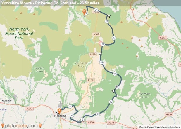
Route: From Grantown on Spey to Aviemore with a circular loop visiting Loch an Eilein, 26.33 miles

Aviemore_Marathon_Route.png

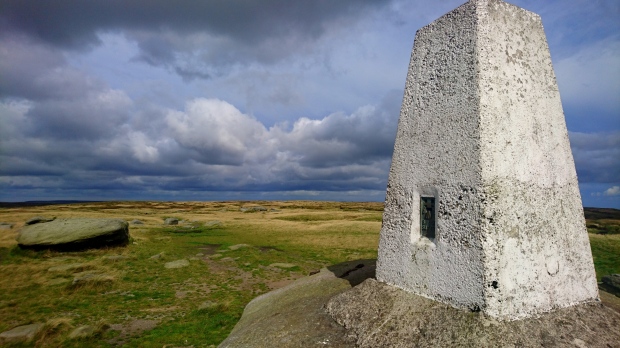
The day of our final marathon had arrived and we were excited and relieved. The constant pressure of marathon after marathon had left us little time to relax during the last 27 days and we were looking forward to a rest! After much discussion about the forecast for high winds and little to no visibility at 900m, a last minute decision had been made to change the route in the Cairngorms National Park to a low level option. Although we both like to get up high, we see no point when walking conditions are near impossible and you cannot make out each other’s faces!

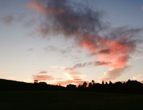
The new route required us to get a bus out to Grantown-on-Spey in the morning. With the weather due to worsen during the day, we had agreed to get the first bus out in the morning. By 6:40am we were ready and hastily made our way to the nearby bus stop. Unfortunately, our haste resulted in Pam going over on her ankle and she winced in pain as she made the last few steps to the stop. Pam quickly shrugged off her discomfort and assured me that all was ok. Once again, we marvelled at another red sky that lit up the Cairngorm plateau as the sun rose to the East of it as the bus took us to our start point. We both wished that we could stop and get some proper pictures but instead committed to freezing the images in our minds.

fullsizerender-2

By 7:25am we had reached our destination and piled off the bus to start our last and final run. Our route followed the Speyside Way, a disused railway line, consisting of gentle grassy paths and gravelled tracks in excellent condition. The track was fun to run on and we had to reign ourselves in as we completed the first couple of kilometres in record time. Bouncing along with our poles tapping the ground, sheep, cows and even a couple of red deer looked on in interest. We were clearly a strange sight made stranger by the tapping noise that we were making and vibrations that passed through the ground.

Passing through Nethy Bridge, a small group that was congregated on the forest track in front of us, shouted “Welcome!” as we passed; clapping and cheering us on our way. We had no idea who they were and were quite embarrassed by the reaction we got. We hurriedly went on our way, only later wishing that we had engaged them in conversation. They looked like they had a clear purpose in mind and we would have loved to have known what they were up to. With my left leg getting very tired and weary once more, I was relieved when Pam suggested that we stopped at the next village for a reviving cup of tea.

dsc_0675

We entered Boat of Garten, a small village with excellent views of the River Spey and Cairngorm hills beyond. Feeling somewhat underdressed, we entered a very smart hotel to seek refuge from the weather and to purchase a hot drink. The receptionist kindly took pity on us and ushered us into a very stylish bar area. We did not want to sit down for fear of messing up the leather seats and were cautious not to leave muddy footprints on the wooden floor! We need not have worried as all the staff remained remarkably friendly to us throughout our visit; even giving us some quality fudge to go with our pots of tea.

Over to Pam…….

Finding it hard to pull ourselves away from the warmth of the hotel bar but realising that we were getting too comfortable, we rain-jacketed up and stepped out into the rain. Although the weather was forecast to be OK until mid-afternoon, the rain and wind were coming in fits and starts; all slightly frustrating with the whole jacket on, jacket off situation. Still the end of this challenge was so close by now that the remaining 15 miles would hopefully seem to be simply a walk in the park (or rather a run in the park!).

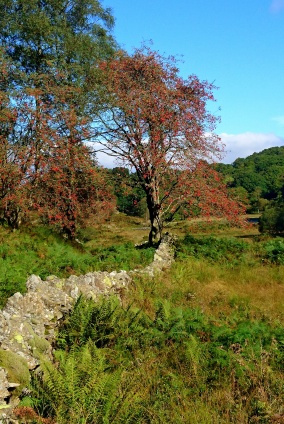
The beauty of following a well-established route such as the Speyside way is that navigation is far easier, allowing us more time to relax and enjoy the whole experience; which we did. The short road section soon turned back into gravel tracks as the wood enveloped us for a second time. The moving on of the seasons was really apparent here in the changing colours of the silver birches, as was the growing carpet of fallen leaves and cones. Only the Douglas firs were fully retaining their foliage.

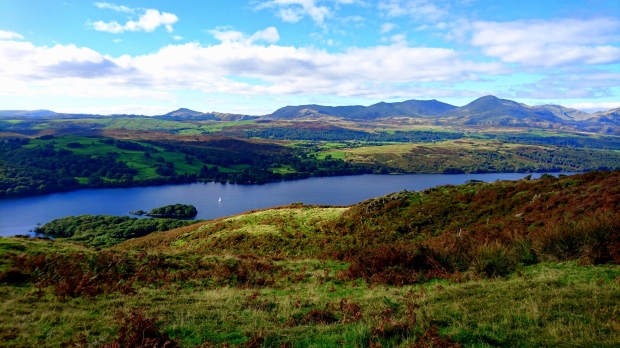
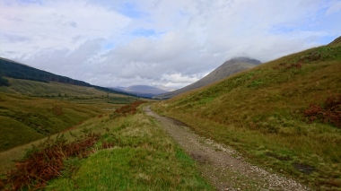
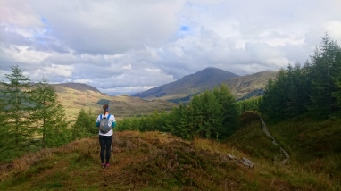
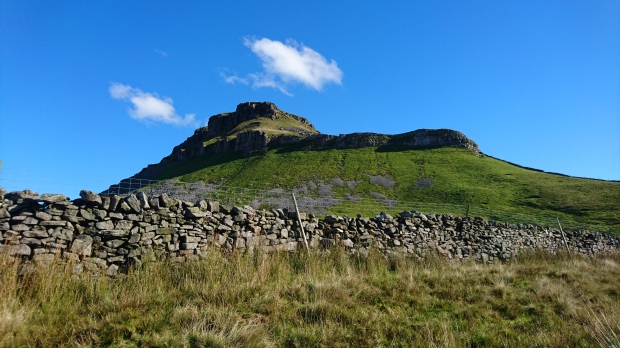
It was not long before the forest opened up into large expanses of heathland, the bilberry bushes being swapped for swathes of heather. The wind has dropped slightly too and there seemed to be almost a brief amnesty from the dark grey clouds over the distant Cairngorms Plateau, as the sun temporarily broke through to afford us stunning and atmospheric views across to the mountains. It was at this point that it hit us how beautiful this glen walk was. Like in the Lake District when we did the lower-level Coniston Marathon route, we were pleasantly surprised and impressed with the level of enjoyment that we were feeling. Both marathons have reminded us to explore all of the areas that these special National Parks have to offer, not just those up high. There are amazing views all over and for times of bad weather or simply on days set aside for rest, routes like the Speyside Way are fantastic opportunities to see these parks from a different perspective.

The bad weather reprieve over too soon as the strong winds up high forced the dark storm clouds to swallow up the mountains again. Congratulating ourselves a second time on the wise decision to change our route, we strode out, thoroughly relishing the fast, comfortable trail under our feet. The appearance of a golf course ahead of us indicated that we must be getting close to Aviemore, our next refuelling stop.

dsc_0685Choosing to run the Aviemore Orbital track to maximise on the off-road paths, instead of traipsing along the main road, we dropped into town just a few hundred metres from the amazing Mountain Café. Unfortunately we had not realised that it was closed on Wednesdays. Slightly disappointed, we continued on in search of a suitable replacement, promising to return the next day for coffee and a slice of one of their fabulous cakes.

Successfully finding a great substitute in Ashers Bakery, just a short distance down the road, we piled into its warmth, the wonderful smells making us start to salivate. With so much choice, we found it hard to narrow our decision down to only one savoury and one sweet option each. The friendly ladies behind the counter were curious and surprised at the amount of food that we had ordered. Trying to explain our efforts so far that day and hence the source of our hunger seemed to leave them only more confused.

“What are they doing?!” one whispered to another, when she thought that we were out of earshot!

Oh well, obviously a few more in the ‘think we’re crazy’ camp then!

Fed and watered, with a quick stop back at the van to swap a water bottle for our filled hip flasks and we were back on our way to finish off the final seven miles. Trying to keep to the low-level route theme, we had decided on a circular loop from Aviemore, via Loch an Eilein, to complete this 15th marathon. This time we swapped the Speyside Way for the Old Loggers Way, along to Coylumbridge and down through another wooded section to the Loch. Our plan was to take this last section gently since by this stage Claire’s knee and my ankle that I had so stupidly rolled at the start of the day were beginning to play up. The shear fatigue in our legs meaning that our muscles were no longer able to protect our joints as well and the repeated battering and bruising that they were experiencing was starting to make itself known to us continuously now.

Again, the beautiful scenery provided sufficient distraction to keep us pushing through. That and an interesting conversation with a local guy, called Neil McGuiness who was out walking his trusty terrier Becky. Very much keen to spend a minute or two chatting, he inquisitively asked after our day and of our reasons for running along one of his favourite dog-walking routes. This time our explanations seemed to make sense, especially as we mentioned that one of the science focuses for this National Park was to incorporate the physics behind whisky distilling. It turned out that Neil had worked as a truck driver for Chivas Regal, travelling all over the country to deliver this much desired liquid. He was also quick to point out some of the practicalities involved that we had not even thought about. For example, the difficulty in transporting a semi-full tank compared to transporting a full one and its effect on stopping distances and cornering. A full tank allows the tank and whiskey to act as one since there is no room for the whisky to bounce and reflect off the sides of the tank; the centre of mass of each acting together from one point so returning to a stable position quickly. This means that if the tank quickly comes to a standstill, so does the whisky. However, with a semi-full tank, the whisky has room to slosh around, reflecting off the sides of the tank causing a large additional and delayed force on the sides of the tank. The momentum of the liquid slows down the motion of the tank as it rights itself to be stable again, resulting in much slower braking or turning to maintain stability.

dsc_0688

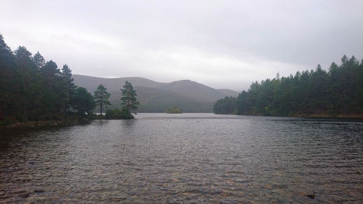
With a friendly goodbye, we continued on, hampered more and more by our aches and pains and increasingly grateful for the easy access of the path. The National Park have put a lot of thought into the accessibility of their trails, most suitable for wheelchairs, pushchairs and exhausted, limping runners! Eventually, the loch came into sight, a beautiful place to walk and cycle around, or simply to sit and take in the views. The availability of another cup of tea from the small visitor centre was much welcomed, along with a wee sip or two from our hip flasks; part of our pact to celebrate our final effort. With only three miles to go, we felt that we could indulge in this small treat.

dsc_0690

Completing those final miles was more a case of relief rather than pleasure since my ankle had started to balloon impressively and the pain in Claire’s leg was severely limiting her ability to bend her knee. Between our injuries, we finished this whole challenge resembling more like lame zombies than sprite runners, but at least we finished!! What an adventure it has been and a delight to finish it off in this stunning National Park. We have had so many fun (and tough) experiences that we will definitely look back very fondly on this in years to come.

Our final ‘mission’ was to shower and drag ourselves down to the Cairngorm Hotel for a celebratory glass or two of prosecco, with a tasty Mexican dinner to follow!

dsc_0691

One last mention must go to Brian McCormack, a retired teacher who we met in said pub and who regaled us with funny tales of his time teaching and his past adventures in the amazing Cairngorms. Hopefully, he will successfully navigate his way through the complexities of the internet, without the aid of his beloved Maureen, to read this blog. We sincerely hope so.

Loch Lommond and The Trossachs Gallop

Loch Lomond and The Trossachs Gallop

Route: From Bridge of Orchy, a circular route up and down Beinn Dorain and then on to Ardlui, 27.51 miles

Loch_Lomond_-_West_Highland_Way

Creeping out of our hikers cabin just prior to first light, we were excited about the day ahead. We had decided to include a stretch of the West Highland Way and a Munro called Beinn Dorain in our penultimate marathon. We were looking forward to the opportunity to get up high in the morning and then socialise with fellow West Highland Way walkers in the afternoon.

dsc_0600A short drive later and we were in position at Bridge-of-Orchy station ready for our tramp up Coire an Dothaidh. Bothy shelter, warm kit, GPS and radioactivity meter packed, we were good to go for our morning ascent. Our Science topics of the day were to be the material science involved in outdoor gear and background radioactivity. We confidently strode up and along the track which followed the river up to its source. It was not long before we slowed for fear of sweating too much. By going too fast, we were at risk of having to endure the constant battle of multiple clothing changes and experience had taught us that it was best to avoid this. With the sun now risen, mountains and rivers started to creep out from the clouds which smothered them. We stopped to look around and marvel at the glens which stretched out below us.

dsc_0602
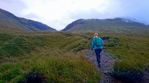
We soon approached the saddle at the top of the coire and turned right to walk along the ridge line that led to the summit of Beinn Dorain. We could see the cloud base sitting a short height above us at about 700m. As we started to prepare ourselves for the wet, cooler conditions that we would soon envelop us, a pair of rare ptarmigans came in to view. We stood dead in our tracks, keen to stop and stare at this rare and privileged sight. Pam quietly got her camera out and hastily took a few photographs of them.

dsc_0615

Onwards and upwards, we followed the path which led around the side of Beinn Dorain. With slippery rocks, exposed ground and serious consequences of a fall, we watched every step and took our time. Although visibility was limited at times, we were grateful for the light south westerly wind. There was the threat of 150 mph gusts later in the day so we were pleased to be planning our descent well before then. Just prior to the summit we stopped to take another radioactivity reading. This was fairly high relative to the other readings that we took during the day and was comparable to some that we got at Dartmoor, which lay on an enormous granite batholith. We concluded that this reflected the nature of the schist rock lying underneath our feet. Mudstone that had been subjected to immense temperatures and pressures thousands of years earlier. This had caused the original minerals within it to recrystallize into new minerals forming harder schist rock that in turn emitted background radioactivity at more regular intervals. The process by which solid rock changes its structure in this way is called ‘metamorphism’.

dsc_0617

We did not stop at the summit for long, as although our upper bodies were warm and dry thanks to the Craghoppers Goretex jackets, my feet were starting to go numb from the cold and Pam’s fingers were doing the same. We waited for only a minute or two to check whether or not the cloud that swirled around us would lift to grant us a summit view. We could see the sun trying hard to break through but it was not going to be enough to warm our extremities. We nodded at one another, our signal to turn and commence the descent. Once the exposed section was over, we skipped down the last couple of miles to the van. We felt immense gratification as we passed multiple walkers on the way up; all before 10:30am!

With the glen bottom now in sight, we discussed what kit we could swap in preparation for the West Highland Way section. Warm clothes were still going to be required as we would have a long wait for the train at Ardlui at the end of the day. On the other hand, water could be reduced as there would be stops available on route. Finally, at the van, we both started to shiver as we felt the cooling effects of evaporation. Our bodies were still sweating from exercise but as we were stationary we were no longer generating heat at the same rate. This left us losing more heat than we were generating and we were getting cold as a result. A quick top layer change and bag faff, followed by plenty of refuelling and we were ready to run!

Over to Pam……..

So with seven miles and around 80% of the ascent under our belts, we set off with a real spring in our steps. The journey from then on was along the beautiful West Highland Way; something new to both of us, though Claire was very familiar with the area having supported her dad and partner when they walked this popular path a few years ago. The full distance of this way is 96 miles, traditionally walked from the South to the North. However, we only needed to do another 19 miles and due to logistics, were going to run it against the usual flow of walkers. The big bonus of running it this way around was besides a few ‘lumps’ to climb up, the overall route was downhill to Loch Lomond and the sea; some relief for our tired legs after the Northumberland effort the other day.

September is supposedly a popular month to walk this route since weather is usually more stable and the infamous midges are far less prominent. This was clear to see as we passed several couples and groups, most with heavy packs and sturdy boots, along the Old Military Road out of the Bridge of Orchy. One such group were fellow residents at the campsite (Pine Trees Leisure Park) that we had stayed at the night before. No doubt they were slightly confused to see us running the opposite way and at a later hour than our early departure that morning would have suggested. Enjoying the fast, bouncy trails far too much to stop to explain, we simply smiled and called out our hellos in response to their surprised looks as we sped by.

dsc_0623Although a low level route, the views up to the mountain tops and along the glens were still outstanding. With the cloud level rising as we headed towards late morning, we were now able to see the top of the Munro that we had walked up earlier. It was difficult to reign in our speeds as the open, level terrain called out to spin our legs, so it took a fair amount of self-control not to over push our efforts. We still had a reasonable distance to run, as well as one more marathon in the Cairngorms in two days time. dsc_0653
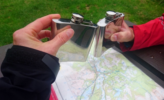
What was needed was a coffee stop in Tyndrum. After a steady climb up to meet the road and railway line (Two key features that we would cross many times throughout the rest of the day.), we then had a very pleasant downhill run into our chosen break point. The very busy Green Welly Stop in Tyndrum not only provided much needed coffees and hot pasties but also the opportunity to buy two hip flasks. To celebrate our achievements during this month (and to help numb the now familiar ache in our knees and feet!), we had decided that we wanted to carry a little whisky with us on our final marathon.

dsc_0635Suitably fed and watered, with new purchases crammed into our small running packs, we were on the road again. From Tyndrum the Old Military Road joined the main highway of the A82 and our path diverted off to a pretty, clearly defined path along the river. Passing through a small woodland and a disused lead mine, followed by a short climb across the heathland, we entered an area of significant historical, environmental and scientific importance. The West Highland Way takes you past the Kirkton and Auchtertyre Farms, where Scotland’s Rural College (SRUC) have established the Hills & Mountains Research Centre. The main purpose of this project is to look into ways to reduce greenhouse gas emissions through economically, environmentally and socially sustainable land management systems (http://www.sruc.ac.uk/info/120252/hill_and_mountain_research_centre). We took a long while to travel past this section since we kept getting distracted by all the interesting information signs that the SRUC had set up. We were really impressed with their holistic approach to the whole project.

dsc_0639

It was at this campsite, whilst taking our 6th radioactivity measurement of the day that we met Lizzie and Ben Cumings. Lizzie, curious as to what were up to, came over for a chat. However, on learning that she was a wildlife biologist, we were far more interested to hear about her stories of environmental research work that she carried out across North America. Researching into the lives and behaviour of a range of animals, including rare mice and seabirds, she had worked in some amazing places such as the Everglades, San Francisco Bay and Hawaii. The latter location is where she met Ben as he flew her to safety from an incoming hurricane; but that is another story!

dsc_0647
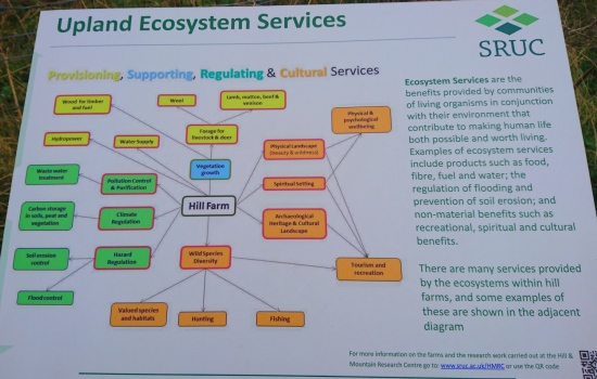
After this interesting conversation, we headed off to start the final ascent of the day, thankfully only a couple of hundred of metres this time, into the forest and still along good tracks. It is always pleasant to have a change in environment to keep our interest constant and we enjoyed the shelter and muted light of the trees and green, mossy carpet. It also coincided with the light rainfall forecast the day before; perfect timing and it saved us from having to dig our rain jackets out of our bags. Eventually the rain lifted and the canopy opened up to amazing views across the valley.

By now the afternoon light was also starting to soften as it approached 4 o’clock, so it was with some relief when the path started its descent towards Ardlui. Although we still had about nine miles to go, we had re-joined the Old Military Road again, providing firm and fast terrain underfoot. It was not too long before the valley opened up and levelled off as we drew closer to our end point.

SS

A small break in the quirky and warm Drovers Inn gave us a small boost of energy for the last two miles. We had guessed that these would not be the most pleasant, having to hug the edge of the fast A82, but unfortunately a necessary evil to reach Ardlui, our end destination. Although the drivers were considerately giving us space as they passed us, we were pretty desperate to complete this final section before the daylight faded for good. So with gritted teeth and ignoring the tightness and pain in our now sore and exhausted legs, we pushed on, both of us shouting and laughing happily when we finally spotted the comforting lights of the Ardlui Hotel. With the penultimate marathon complete there was time spare to grab a tasty dinner and some light-hearted conversation with the regulars. An hour passed and it was soon time to catch the train back to the van in Bridge of Orchy. Happy times; a truly enjoyable and interesting day along a beautiful route! I’m sure that it will not be long before we will head up here again for another visit back to this gorgeous National Park.

Our Northumberland Venture

Route: Circular route from Ilderton, 26.79 miles

Based on our previous experience of the remote and wild Northumberland National Park, we always knew that this would be one of the toughest marathons out of our Challenge and we were not disappointed! Boggy terrain, disappearing paths and over-zealous cows are only part of the story, but more on than later. Put it this way, this marathon kept us on our toes! However, we were incredibly lucky with the weather and very relieved since neither of us was keen to revisit past experiences of poor visibility, super strong winds and needle-like rain!

Aware that psychology plays an enormous part in any adventure, we had treated ourselves to a second sports massage, this time at Scarborough Sports Massage Clinic. Understanding our plight, Christian Machen expertly manipulated out the knots and tightness that had been building in our legs and bodies over the past few runs.  A big thank you Chris!

dsc_0543

On top of this uncomfortable but much appreciated luxury, we had made the decision earlier in the week to walk this marathon. It would give us more time to navigate, which we knew could be particularly challenging over and through the heather covered moorland. Oh, and being gluttons for punishment, we were also wanting to get some good data on the effect of sugar on energy levels during an endurance activity. This had been our plan during the New Forest marathon but the humidity seemed to have affected the blood sugar monitor. Since neither of us wanted to suffer any more than necessary when playing around with our nutrition, nor to be the one to have to drag the other round on a tougher course because of said nutrition, walking seemed to be the sensible choice.

dsc_0555

So one of the first tasks of the day was to measure our blood sugars before we could eat breakfast; everything we ate and drank for the next few hours would need to be recorded, along with timings so we could correlate this information to our blood sugar readings. Again, Claire was on the more balanced protein-carb-fat diet of porridge with cheese sandwiches for snacks, whilst I had the pleasure of consuming a breakfast of 500ml of Lucozade Energy drink, supplemented on route with fruit snacks! Mmmm!

dsc_0542

We were conscientious that daylight hours were shortening and we had approximately 1200m of ascent to climb, so it was going to be a long day and we needed a much earlier start. A beautiful red sky greeted us as we drove to our start point in Ilderton, to the east of the Cheviot. This part of the Northumberland National Park is much less popular than the region to the west, where its highest peak and the Pennine Way capture the attention of many walkers throughout the year. With this in mind, navigation was always going to be more challenging, though we had not quite realised how much. No sooner had we started before we stumbled into our first obstacle; a perfectly clear bridleway disappearing into a sea of heather and bracken, only to be replaced by numerous sheep-trodden tracks.

“Any idea which way it went?”

“Er, no! The map implies that we should just keep heading that way,” as we stared across the purple and brown carpet. And so we did, our ankles sinking amongst the clumps into shin-deep mud, as were our energy levels. Finally spotting a post, the top half-covered covered in yellow footpath signs, we tramped our way over, fervently hoping that this will lead us back onto a decent path. Great! It did and in the right direction so off we set again. Five minutes later though, we were back in the same situation again; this path disappearing to nothing and no clear way to head from there. We could not even use sheep folds or fence boundaries to locate ourselves since there seemed to be hundreds all over that did not fit to the map.

dsc_0545

“Right, the only thing that cannot be wrong are the contours. No one can move the mountains,” Claire sagely stated. Back to basics; macro-navigation of key landscape features and good old compass bearings. By this stage, I was next to useless as the sugar high from my Lucozade breakfast had turned about face into a sugar low. Along with plummeting energy levels, my concentration and mental processing skills were dropping off quickly. The only that was increasing was my headache! This all meant that any sensible decision making and pace setting was left to Claire. If you are interested in our results, see the graph below.

blood-sugars-graph

It was with a massive sign of relief from both us when we reached 11am and our designated time to finish this experiment; me to be able to have some real food and Claire to have a functioning partner again! We had also got beyond the most challenging navigational section of the route, another big bonus. Fuelled up on cheese sandwiches, we started the ascent, this time of much clearer tracks, up to the Big Cairn and High Cantle. Our destination was Salters Road through the forest, heading towards the Pennine Way where we would do the main part of the ascent up to the summit of the Cheviot. Despite the gradient, we significantly picked up pace, showing clearly how the terrain underfoot made such a big difference to our speed; and how the consumption of food made such a difference to our energy levels and morale.

Half-way through the forest and with nine miles under our belts, we finally met other people out walking. A chatty couple from Tyneside who were trying to retrace their steps from an earlier visit to Davidson’s Lynn but doubted whether they were on the right track. A quick look at the map helped to confirm that they were; a good thing since we needed to be on the same track ourselves.

dsc_0558
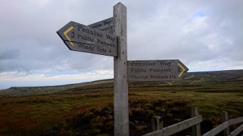
Finally reaching the Pennine Way, both of us were surprised and immensely relieved to see the flagstone path extending ahead of us. Our distant memories of walking this path had dredged up images of bog after bog, something we had secretly been dreading but too afraid to voice to each other. It seemed in 2013, the National Park Authority had put in some very hard labour to build this path, kindly funded by Natural England and for that we were truly grateful. We almost skipped up to the summit, where we met two lovely ladies, equally wind-blown and dishevelled but on good form. With the weather still being kind enough to allow us fantastic views across this remote and wild National Park, it was clear to see how Northumberland takes the crown as the largest Dark Sky Status Reserve in Europe. There are hardly any settlements to create light pollution and it was a shame that we could not afford the time to visit this secluded area at night. The view of the stars and the Milky-Way must surely be amazing from here.

dsc_0563Over to Claire……

Commencing our walk from the summit over to the edge of the plateau, we were pleased to see further flagstones stretching out into the distance. The Northumberland National Park really have gone to the sterling effort of laying stones down for common walking routes, one of which we were now on. Standing at the edge of the plateau, we could see the descent down into the picturesque valley below. We were eager to get down as were feeling drained and tired from being battered by the wind all day. Briefly breaking into a trot we started our descent down and let our tired legs roll. This was short lived as our bodies had got so used to the more sedate walking pace that they were groaning at us to slow down. We had learnt to listen to our bodies at moments such as these so reigned ourselves in. We were aware that there was no need to rush as we were making good time.

dsc_0553

It was not long before we were down and sheltered from the strong gusts that roared on the summit above. Tired but happy, we smiled at passers-by as we carried along the valley. We commented on the strength of a runner as she easily strode out past us. We quietly envied the energy and vitality she possessed and looked forward to the day when we would be that bouncy again!

Reaching the end of the valley, we took on-board some more food and water before starting the last 4 miles. We were happy to be off road and onto a soft grassy surface again but our contentedness was short lived. Having walked past many fields with cows, calves and bulls in during our marathons, we had got somewhat cavalier about walking through fields of them. Confident in our approach we set out across another full field, the cows were clearly unhappy about our presence and started making noises at us as their calves became a little spooked. A bull suddenly appeared and started approaching us. We made noises at it but it wasn’t backing down. As it broke into a run, I called out to Pam, “Go up the hill!” I heard a shout behind me as Pam slipped whilst making headway for the hill. I had a sick feeling in my stomach as I reached the fence line and turned to see what had happened. Relieved to see her back on her feet again and the bull stood stationary at the bottom of the hill, I started to climb over the fence with Pam close behind. On edge after our close call, we chose to follow a fence boundary around the herd rather than face the might of these anxious animals. They had made it clear that we were not welcome and we did not want to upset them again!

dsc_0544

Eventually reaching the ruins of Middleton Old Town, we slowed down to reflect on the history that had been created here. Lying on the boundary between England and Scotland, this county has witnessed many battles that have shaped the land and lives of its people. With the clock ticking, we drew ourselves away and continued on.

We questioned our luck as we went through a gate and realised that we were now in a field of inquisitive bullocks. Keen not to have another near miss, we kept an eye on them as they stared at us intensely from the top of a hill. Aware of how fast they could run, we kept close to our escape route, a nearby drystone wall as we ventured along the track. Safely through the gate on the other side, we decided that we had had enough cow experiences for one day.

With IIderton in sight, the van soon came in to view. Tired and weary, we had a quick change before seeking the refuge of the van. Due to its remoteness and difficult terrain, we always knew that this would be a difficult marathon to conquer. Its challenge had certainly not disappointed us and although unlucky for some our 13th marathon had proved otherwise. We had had a number of lucky escapes that would no doubt be remembered over a drink or two in years to come! Thank you Northumberland for making our day such a memorable one!


North York Moors Welcome

Route: From Pickering to North of Goathland, 28.0 miles

Yorkshire_Moors_-_Pickering_To_Gothland

The North York Moors with it’s fantastic coastline and moorland is somewhere we were both keen to explore. We both had distant memories of the region and were looking forward to re-awakening them. On the morning of our run, we were both a little nervous as to what the day had in store. We were dependent on a friend’s (Martin Kocsis) goodwill to make it a success. Not only did we need him to pick us up half way through our route to take us to a pre-arranged meeting with the North York Moors Education Officer, Sue Wilkinson, we also needed him to drive us back to Pickering. We should not have worried, Martin and his trusty dog Frank proved to be excellent support and hosts for this park!

With rain drizzling upon us as we sat in the car park at Pickering waiting for Martin, we wondered whether or not our rain jackets would have to make a rare outing. We had got so used to sunny running conditions that the threat of a rainy day was having a bigger effect on our spirits that it should have done. Our frowns turned into smiles as Martin and Frank pulled into the car park. Martin was a big fan of the region having spent many happy days holidaying here in the past. His enthusiasm rubbed off on us as we got our selves sorted, explained our plan and set off in to the drizzle for our day’s adventure. Within minutes the rain had stopped and we had the smoke of a distant steam train in sight. We marvelled at it from afar as we drew close enough to get a couple of pictures. Keen to keep on schedule for our visit with Sue, we hurriedly packed the camera away and continued on route.

dsc_0491

Route planning, pacing and timing, all applied physics topics, were something that we had got increasingly good at during the past 3 weeks. As a core skill of a competent Mountain Leader, we both had experience of using these skills in the recent past. However, neither of us had had any experience of completing so many marathons in such a short time frame and as such our pace had to be modified. We also had little knowledge of some of the terrain that we would encounter and were concerned that the North York Moors would be exceptionally boggy underfoot; sapping our energy levels and hindering our progress. To allow for these unknowns we had factored in plenty of contingency.

Keeping to our moto of ‘walk the ups’, we took our time as we climbed out of Thorten-le-Dale, through the forest and up onto the ridge. The height gain was only 200m and slight compared to our previous marathons effort. We chatted merrily as we reached the ridgeline and marvelled at the North York Moors laid out before us. Multiple shades of yellow, green and brown rolled into the distance and shimmered in the sunlight; we could see why so many people loved these moors. We discussed how different the shape of the landscape was from the Lake District in the West, to The Yorkshire Dales in the middle of the country and the North York Moors in the East. Each park had its own discrete characteristics and unique charms that had left lasting impressions on us. Much to our delight the chalk tracks underfoot made the running easy. We drifted along at a good pace taking care not to run too fast and burn out later as a result.

dsc_0498

With our energy levels dipping and the sun occasionally popping out from the clouds, Pam compared us to road runners. These are birds which harness the warmth from the sun so that they can break into a sprint. Chuckling at this thought, we saw two runners approaching us. Armed, like us, with poles and taped knees they smiled and nodded before shouting “Hello fellow idiots!” at us. Pleased to be in the presence of like-minded souls, we shared in their joke before carrying along the Tabular Hills Walk.

Myself as time keeper and Pam as distance master, we could see that we were making good time and were likely to get to our first rendezvous point with Martin about 30 minutes early. A short phone call was made and we agreed to meet with him a little earlier to give us more time to recharge our batteries and rest our tired legs. Within an hour, we could just make out the outline of Martin and his husky, Frank on the horizon. They were slowly walking along the track towards us. Pleased to have an excuse to walk, we hurriedly ran towards them before slowing to a more sedate pace. With the sun now shining brightly upon us, we shared stories of our mornings adventures before piling in to Martin’s van.

Over to Pam……

So Martin kindly drove us both to Aidensfield… or rather Goathland as it’s known by the locals. This enchanting village has been the set for the Sunday evening favourite, Heartbeat for nearly 20 years. On route we had excellent views of the moorland that would be our playground for the afternoon. The familiar sights of the Aidenfields Arms and garage were standing proudly at one end of the village; both buildings the focus of many photos. As was the police car, which was currently parked up in front of the village post office and information centre since its usual location in front of the garage was taken over by a small market on this occasion.

To make room for Claire and I to fit into the van (safely), Frank had to be relegated to the back of the van for the short journey, much to his disgust. However, he was obviously not one to hold grudges for long since he happily turned on the charm once again when the cream teas arrived. With a quick half hour spare, we had all decided to test out the local delicacies, whilst lazing in the sunshine on in the small green outside and making sure that all scones were out of reach of Frank’s dextrous paws!

dsc_0507The short break over, it was then time to meet up with Sue. This called for a second cup of tea and the more business-like setting of the tea rooms. Like all of the Education Officers from the different National Parks that we have met so far, Sue is incredibly enthusiastic and motivated about increasing the opportunities for families and schools to experience the beauty of these special places. Her knowledge and passion for this understated but truly captivating Park is second to none and it was fascinating talking to her about the numerous projects that the North York Moors National Park Authority has on the go. One such project is the Explorer Club, an opportunity for 5-14 year old children and their parents to meet up and learn more about the Moors over six sessions. The success of this project clearly shown by the continuing involvement of these families with the Park and their own exploring even after their designated period of learning has finished.

This is only one of many schemes that are available for children to become more engaged with the outdoors in the North York Moors (www.northyorkmoors.org.uk). As teachers who passionately feel that learning about Science and Physics should not be only restricted to laboratories, it was very encouraging to meet someone who has been so actively involved in establishing strong links between education and opportunities in the outdoors. Both of us were impressed by the amount of research into this special peatland environment that is already taking place. Despite very much enjoying our conversation with Sue, we were conscious of time pressures; Sue had kindly taken time out her day to meet with us and we still had another 6.5 miles to do!

dsc_0520
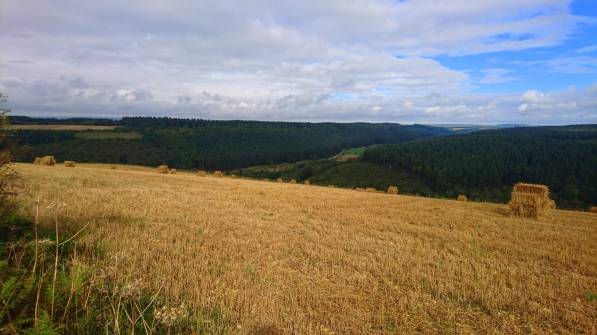
So shuffling back into the van, (Frank again in the back!), it was time to head back to the view point at Saltergate. If the morning had been all about forest trails and farmland, the afternoon was very much about the moors. Starting with a quick jog around the Fylingdale RAF Base, most likely monitored by several CCTV cameras, we soon hit the chalky trails of the Worm Sike Rigg bridleway. The short climb uphill opened up to wide open moorland, the heather and moorland plants turning slightly golden in the lower autumn sun. It almost felt as if we were running through the plains in Spain, only the cooler northerly breeze reminding us of where we really were! It really is a very magical environment and we were incredibly lucky to be able to experience it in such beautiful weather.

dsc_0521
The chalky trails turned to peaty-sandstone paths as we passed the trig point and turned onto Foster Howes Rigg. Although much more uneven and boggy, we still managed to hold a reasonable pace, the lure of the end now in sight. We were quickly realising that the 6.5 miles that we thought that we had to do, was now nearer to 8.5 miles so we were incredibly grateful to see the friendly faces of Martin and Frank as the path neared towards the A169.

dsc_0526Fantastic, number 12 done! All we needed to finish off this wonderful day were three very tasty portions of fish and chips (with a large sausage for Frank, of course) and a short stroll around Whitby.


A big thank you to Martin for all the support and for the guided tour of Dracula’s home town; perfect!

dsc_0536

Yorkshire 3 Peaks

Route: Circular Route from Horton-in-Ribblesdale, 26.3 miles

yorkshire_3_peaks_marathon

Waking up to another beautiful sunrise and blue sky, Pam and I were excited about the day ahead. The Yorkshire Dales is famous for the Yorkshire 3 Peaks and that was to be our focus for the day. Driving into the park the night before, memories of caving, climbing, running and leading Duke of Edinburgh expeditions had come flooding back into my mind. With its rich history, amazing limestone pavements and diverse geological features, it had also been somewhere that Pam and I visited during a fieldwork trip at Liverpool University. We chuckled at how we had thrown snowballs at each other when we were supposed to be studying a geological feature called an unconformity. Ok, we may not have been as focused as we could have been but we have never forgotten that unconformity because we were having so much fun!

_20160921_104624

As Pam and I slowly got ourselves ready, Zoe, our companion for the day excitedly shared with us all the extra equipment that she had brought with her. Zoe is an Atmospheric Research Scientist, an excellent runner, skier and mountain biker and a constant source of energy and enthusiasm. Like us, she is passionate about sharing Environmental Science with families, schools and children and sees outreach projects as fundamental to the work she does. She has worked on research projects in Antarctica, with young adults through the British Exploring Society and has also worked voluntarily for the Peak District National Park.

Our scientific focuses for the day were going to be weather phenomena across the three peaks and the amazing structures that we saw on route. Armed with an ozone detector meter, two temperature and humidity meters (One on Zoe’s back pack and one on mine) and an anemometer to measure wind speed, we were well equipped. Zoe had also brought with her a carbon dioxide and air quality meter. As this needed a power supply, we chose to use this at the start and end of the day rather than throughout the run. Our investigation into amazing structures focused on dry stone walls which are so well preserved and maintained in this park and arch bridges such as the Ribblehead viaduct. Hundreds of railway builders (“navvies”) lost their lives building this viaduct, with its 24 massive stone arches 104 feet (32 metres) above the moor. It caused such loss of life that the railway paid for an expansion of the local graveyard.

Bags packed, scientific equipment attached and plenty of coffee and tea consumed, we piled into my van and drove the short distance to the start of our route at Horton-in-Ribblesdale. With Pen-Y-Ghent, the first of the three peaks in view, we eagerly started our run towards it. Within 40 minutes we were nearing the top. It was good to be feeling so strong and positive after issues with my leg the day before had stopped me in my tracks. The benefit of a massage from Lynne Taylor of Global Therapies was definitely paying off as my legs happily pushed me up the final short scramble to the top. Pam was grinning with delight as the summit views stretched out before us, recounting tales of her last excursion here where all three peaks had been covered in thick cloud.

dsc_0457

dsc_0461

Eager to take some wind speed readings, Zoe held up her portable anemometer. We could tell that the wind speed was very low and with it registering as under 1 metre per second, we concluded that it was insignificant. This reading was understandable as the air was exceptionally still in the valley below and we could only feel a slight breeze where we now stood. We stood and stared at the views for a few minutes more, before starting the descent down.

dsc_0464

As our legs rolled underneath us, they were clearly grateful for the relief of the well maintained tracks and paths that lay underfoot. The Yorkshire Dales have made it an integral part of their current plan to improve and maintain the footpaths and bridleways that form the Yorkshire three Peaks walk. Pam and I commented on how noticeable the work the park rangers, contractors and volunteers had done after completing this circuit many years earlier. At over £28 per metre though this is no easy task and they are always looking for sources of funding and volunteers to continue this good work.

With Pen-Y-Ghent behind us, we strode out as we ran along the valley before looping back round towards the Ribblehead viaduct and Whernside. With a tea van and the Railway Inn in site, we decided that we would have to stop for some refreshments before tackling the second of the three peaks. At this point, I would like to introduce Pat who served us tea, ice-cream and soup from her tea van. She was clearly interested in what we were doing and asked probing questions about how Science can be brought to life in the outdoors. We gave some simple examples like energy transfers and cooling through evaporation which seemed to help convince her. We would have loved to have talked more, but the pub and an opportunity to refill our drink bottles was calling.

We were treated to a warm Yorkshire welcome as we wondered into the pub. One gentleman asked how the turbo pack on our bags propelled us up the hills. It took me a few seconds to realise that he was referring to the temperature and humidity meters that were attached to our ruck sacks. When we explained what they were and how they fitted in with the purpose of our challenge, the bar man pitched in,

“If you have completed 10 marathons, you should be good at them by now!”

This left Zoe, Pam and I in stitches as we sat down to rest our weary legs for a few minutes before continuing our journey.

Refuelled, we set off for Whernside. Marvelling at the architecture of the Ribblehead viaduct and it’s 24 arches which towered above us, we started the long slog to the top. Zoe questioned how anyone could cycle this route after reading about the Yorkshire 3 Peaks Cyclo-Cross race in the pub. Always one for a challenge, she was clearly interested in entering this event at some time in the future. She kept us amused, and distracted from the fatigue in our legs, as she weighed up the pros and cons of partaking in this race.

_20160921_104828

At the summit of Whernside, we stopped for a few more photos and admired the views before hurtling down to the warmth and comfort of the Old Mill House pub below. Met by piles of chocolate brownies, lemon drizzle cake and flapjack as we entered the bar, we decided that it would be rude not to purchase any alongside our drinks. With 6 miles to go, we knew that we had broken the back of this marathon and wanted to savour the last few miles. Fellow three peak walkers drank and chatted merrily with us as we all concluded that Ingleborough had a sting in its’ tail. I remembered this all too well after running the Yorkshire 3 Peaks race a few years before. Cramping up as I scrambled up the last few steps, I had to dig deep into my mental and physical reserves to reach the top. Totally exhausted, I eventually collapsed at the summit as both my legs went into spasm. A bit of tender loving care by mountain rescue, the angles of the hills and I was back on my feet again, running the last few miles into Horton-in-Ribblesdale. Fortunately, we were all feeling quite strong as we piled out of the pub and started the final ascent. Passing limestone pavements as Ingleborough stood vertically in front of us, we didn’t let its daunting climb dampen our spirits. With plenty of words of encouragement and sweets from Zoe, the summit was upon us. It was much colder at the top of the three peaks than it was below and this is reflected in the temperature and humidity readings recorded on route. You can clearly see the temperature dropping relative to height as we summited Pen-Y-Ghent, Whernside and Inglebrough at 10:40, 14:45 and 17:00 respectively in the graph below.

yorkshire-3-peaks-hobo-graph-1

yorkshire_3_peaks_marathon

With the colder air and cooling effects of evaporation, we were started to shiver as our bodies tried to warm themselves up. With the three peaks accomplished and the evening drawing in, we saw no reason to hang around. We steadily trotted our way back down to the van. Endorphin fuelled and minds enriched with all the amazing views we had seen that day, we needed nothing more than food and sleep to be perfectly content. They say the best things in life are free and on this day it certainly felt that way. However, to keep these experiences free for future generations we all need to do our bit. This can be done by volunteering our time to assist with National Park path or wall maintenance projects or giving a small amount (£28 per metre) to fund maintenance work.

dsc_0467

The Lake District Wander

Route: Coniston Marathon circuit, 26.23 miles

Lake_District_-_Coniston_Marathon_Route

Waking to another clear day and feeling relatively refreshed after two days of rest, we were ready for the next set of back-to-back marathons. The mental fatigue that we experienced at the end of the Peak District run was now a (semi!) distant memory as we looked forward to a lakeside run in a National Park that both of us have spent a significant time in over the years. On top of this we had taken up the opportunity of a much needed massage the day before by Lynne and Tim, from Global Therapies, fellow fell runner friends of Claire, so our legs were now feeling far less tight and knotty. Although there was still some taping around Claire’s knee, so being kind to ourselves was, as always, still on the agenda. However, the knowledge that we had broken the back of this challenge buoyed us both along. We were feeling good!

dsc_0423

The choice of the Coniston marathon route was quite a strategic one since we were planning on doing the Yorkshire Three Peaks the next day and needed a relatively flat course; or as flat as the Lake District can offer! Again, we were lucky with the weather as the sun shone warmly across the fields with the cool northerly wind reminding us that autumn is already here.

It was then time to set off for the short distance to our start point at the High Cross car park, north-east of Lake Coniston. We had decided on running anti-clockwise around the circuit from this point to get the bulk of the road miles out of the way first of all. We have found that tarmac surfaces have been so much more unforgiving on our legs and we had no desire to pound our joints and muscles on this hard surface at the end of 26 miles. It also placed Coniston roughly half-way around; perfect timing for a coffee and cake stop, as well as being the only feasible place to fill up with water on route.

The road section seemed to pass by quite quickly, much to our delight. We were pretty much on tenterhooks for most of it, since the high hedgerows bordering these narrow roads made it hard for vehicles to see us. At least the earlier start meant that traffic was a little lighter than usual. The fact that it was breakfast time for most normal people was also highlighted to us as we ran past the Drunken Duck Inn, tempting smells of cooked bacon drifting across the road. We had a slight reprieve from the tarmac as we hopped onto a purpose-built gravelled bike trail parallel to the road; not only kinder on our legs but also on our anxiety levels!

As soon as we reached Clappersgate, the actual start point of the organised marathon event, we jumped off the main road onto a quieter one, heading west along the river. Now we could relax a little more and start to enjoy the scenery. It really is a lovely and quite varied circuit, though not to be underestimated in its toughness. This first section took us through short wooded sections, across fields and up over hills. At one point we were treated to stunning views across to the Langdale Pikes, something we may have missed if we had rushed past in a car. There is definitely a benefit or two for taking the time to travel places under your own steam, with this being one of them! With all this in mind, we did admit to each other that we would be tempted to enter the official Coniston Marathon, even though neither of us is big on entering events involving road. The multi-terrain paths were definitely technical and challenging enough to ensure that you would never be bored.

dsc_0431After another short stint along the A593, we were back onto the trails, this time heading towards Tarn Hows. With the huge choice of stunning mountain paths to tempt you to higher ground, it is far too easy to forget the beautiful lowland walks that are also available.  The lake side path of Tarn Hows is an excellent example and we met a number of people already clued in on this, making the most of the gorgeous weather.

Soon it was time for us to drop down into Coniston, for our designated break; a town full of history and strong links to water sports. The long straight shape of Lake Coniston provided the perfect setting for trial runs of the World Water Speed record by Donald Campbell, as well as his tragic record attempt run in his Bluebird K7 in 1967. The Physics and Engineering of the high speed boat is fascinating and thankfully, something that the Ruskin Museum and Campbell Heritage Trust are in the process of restoring for future generations to admire. See the Ruskin Museum website for more details, http://www.ruskinmuseum.com/.

Another cream tea consumed and we were back on the route, this time running along the edge of the lake for a good few miles. In addition to the rich scientific and historic connection of speed boats on Lake Coniston, the popularity of other water sports was also clear to see; sailing boats, kayaks and canoes all in use. All activities use the principles of buoyancy, streamlining and stability to power successfully through the water. As a keen swimmer myself, I have always been interested in how to apply physics to increase efficiency; the inner geek emerged when I was quite young! So it was really pleasing to see one or two hardy souls braving the cold water on this sunny day.

dsc_0438

It was at this point that Claire’s leg began to give her trouble again, and my knees were seemingly starting to ache in sympathy as the previous 250+ miles of our nine previous marathons were starting to take their toll. A little worrying since we were only 13 miles into our marathon and there was still a long way to go. Normally we would be too self-conscious to go through some strategic yoga moves at the side of the track with so many people passing bay, but desperate times leads to desperate measures. We happily swallowed our pride and a few Ibuprofens to ensure that we could continue as comfortably as possible!

dsc_0443

A second sizeable road section towards the end of the lake was a little nerve-racking, so it was with big sighs of relief when we hit the off-road trails again at High Nibthwaite. Here it was very much a case of up, up, up and again a good reminder of how challenging the official marathon must be. To add to our fun, we also encountered a couple of herds of cows, who were equally startled at seeing us as we were of seeing them on the narrowest section of the route. It was a good ten minutes of gentle encouragement from us to coax the poor beasts along before the path widened sufficiently for us to squeeze past.

dsc_0458

The Lake District is one of the most popular areas for locals and tourists to visit, and even at a height of 300m, it was clear to see why. The views across the lake to the Old Man of Coniston and down to the town itself were stunning. This low-level route was exceeding all our expectations and introducing us to areas neither of us had been to before. The final section through Grizedale Forest finished off a truly magnificent day. Just in time to meet up with Claire’s parents, sister and niece for dinner!

dsc_0452

Last but by no means least, a big thank you must go to Graham Watson for all of his help on the Science and Learning that already takes place through the Lake District National Park Authority. Graham is the Manager of the John Muir Award in Cumbria, a highly regarded environmental award that has a strong base here in this National Park. It is an award that is open to everyone, encouraging all to be fully aware of their environment and to engage with it more; perfect for school groups and families. Further details and information can be found at http://www.lakedistrict.gov.uk/learning/johnmuiraward.

Peak District Crawl

Route: From Hathersage to Chinley, 26.31 miles

peak_district_-_hathersage_to_chinley-1

I have many fond memories of running over the Kinder plateau as it is home turf for the Pennine Fell Running Club for which I run. It is also where the first UK National Park was established after the mass trespass of 1932. It therefore seemed fitting to run a route which crossed this famous gritstone plateau. It was always going to be an emotional day but with mixed weather and fatigue setting in, it turned out to be particularly so.

After the Snowdon marathon the day before Pam and I were tired and weary as we woke early for our morning stretching routine. Helen Allison, our support for the day, arrived within the hour to discuss our plans. Helen has multiple talents as she is a formidable ultra-runner, osteopath and downright lovely person. After loading her sack with extra water and checking the forecast for the day, pangs of guilt ran through me. Heavy rain was forecast for the first three hours of our run and Helen now had around 4 litres of water on her back! This was because we would have little access to fresh water once we were up on the gritstone edges and did not want to have to drop down prematurely. I knew that Helen would only be helping us if she believed in our cause, so decided to stop apologising for loading her up like a camel and to accept her offer of support gracefully.

Bags packed and poles at the ready, we piled into Helen’s car and drove over to Hathersage, the start of our run. Our two Science focuses for the day were to be background radiation and the physics of adventure sports like climbing which the gritstone edges form a natural playground for. Gritstone is a coarse-grained, siliceous sandstone which contains clay minerals, feldspar, micas and quartz. This mineral rich rock emits radiation in small pockets as the isotopes within it decay to more stable forms. We were hoping to detect some of this during our traverse across the Peak District National Park. As it happened, we did notice some variations in the readings but they were insignificant when you took the sensitivity of the meter into account. A more extensive study would need to be carried out to confirm our predictions.

A couple of weeks earlier, I had been fortunate enough to meet up with Chris Robinson who is one of the Education Officers for the Peak District National Park. He explained some of the other Science themed projects that they engage young people with whilst out and about in the park. One of the most memorable included measuring the depth of peat bogs which naturally store carbon dioxide (CO2); the gas that contributes to climate change. According to the Peak District National Park website, it is estimated that Britain’s peat bogs store the equivalent of 10 times the country’s total CO2 emissions. This is one of the many reasons to preserve them and to engage the next generation in doing so.

dsc_0412

The rain lashed down on Helen’s car as we drove over to Hathersage. It was not long before the car was parked up and Pam and I had to tear ourselves away from its warmth and comfort. Leg muscles aching from our run the day before, motivation was in short supply. However, Helen’s enthusiasm and curiosity as we took the first of our background radiation readings for the day kept us entertained. We set of again. She let us set the pace as she positioned herself at the back; quietly observing our progress and any signs of fatigue. After a long gentle stretch by the river, we started the steep, unrelenting climb up to Win Hill. It was then that Helen hinted that we could be using our poles a bit more efficiently when we went up hill. Eager to gain any insights that I could from this ultra-running legend, I pleaded with her to demonstrate this technique for me. As she took my poles and stormed up the near vertical slope at a record pace, I felt a little incompetent. She broke down the process for us in simple steps and we slowly went about trying to adopt this new approach. We could both immediately feel the extra work our arms were having to do and if this meant taking some of the weight of our exceptionally tired legs, we were sold on it!

dsc_0403

Eventually the end of the climb came into sight and the summit of Win Hill could be seen on the horizon. Pleased to be nearing the top of the longest climb of the day and with the rain clearing our mood lifted. We posed for some photos at the top before running down the short descent on the other side. It was nice to be picking up some speed again. We trotted along the gritstone edges taking readings on route. As we did I could feel my troubled left leg getting heavier and heavier until I felt that I was physically dragging it along. Not able to hide my condition from Helen’s trained eye, she soon pulled me aside and kindly set to work on my leg at the top of Ringing Roger. Not only had she carried an excessive amount of water up in the pouring rain for us, she was now massaging my leg on route for me. Relieved at the attention my leg was finally getting, I could feel the knots unravelling in it as she massaged it with her magical touch. Minutes later and I was back running again. Helen carried on with us for another mile, before handing over the remaining water and setting off back for her car.

dsc_0409

Pam and I plodded on. Although we were both mentally struggling with the challenge of the day, we both felt immensely privileged to be running this route in such beautiful conditions. Unlike our recce of this route a few months earlier, the ground was now dry underfoot and the views clear to see. We stopped for a few pictures at Kinder Low and another radiation reading before recomposing ourselves and breaking the remaining miles down into small manageable chunks. We both knew that we needed to be kinder to ourselves. We agreed that we would do this by stopping in Hayfield for a coffee and brief rest, slowing the pace down and taking slightly less technical lines wherever we could.

dsc_0414

Tired, exhausted but relieved that we would soon have two days’ rest, we dragged ourselves around the remaining 6 miles from our coffee stop in Hayfield. We felt guilty that we had not given the Peak District National Park the attention it deserved as our minds played tricks with us. Yet, as is so often the case, with time, only the good memories remain. As I write this blog, it is those magical views and unique shaped gritstone outcrops that jump into my mind when I refer back, not the pain or fatigue that we felt on the day.